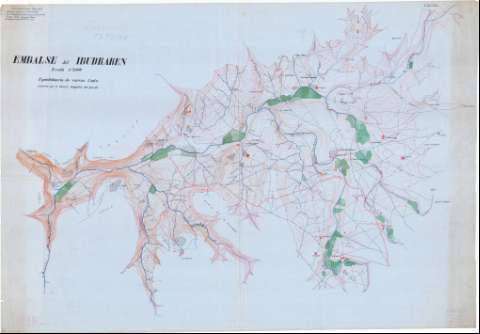
Embalse de Ibudraren


Section: Maps, plans and nautical charts
Title: Embalse de Ibudraren / levantado por el Servicio Geográfico del Ejercito
Material or type of resouce Area: E. 1:5.000
Publication: [1912-1956?]
Physical description: 1 mapa : ms., col., sobre tela para planos ; 95 x 136 cm
Content type: Imagen cartográfica
Media type: computadora
Carrier type: recurso en línea
Notes: Relieve representado por curvas de nivel, equidistancia 2 mts.
Fecha deducida del período del Protectorado
Manuscrito realizado a 5 tintas, negra, sepia, roja, azul y verde
Materia / lugar / evento: Planos topográficos
Depósitos de agua
Embalses
Tetuán (Provincia)
Tánger-Tetuán (Marruecos, Región)
Marruecos
Other authors: España. Servicio Geográfico del Ejército
UDC: (64 Ibudraren, embalse)
Type of publication:
 Maps
Maps
Rights:
Préstamo:
 Disponible
