Lunden


Section: Drawings
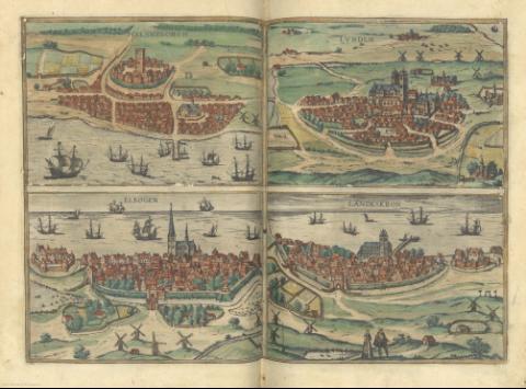
Title: Lunden [Mapa] / [George Braun et Frans Hogenberg]
Material or type of resouce Area: Escala indeterminada
Publication: [Colonia Agrippina : George Braun et Frans Hogenberg, 1572-1590?]
Physical description: 1 vista : col. ; 17 x 24 cm, en h. de 39 x 53 cm
Notes: Presenta una perspectiva, tomada a vuelo de pájaro, de la citada población
Mención de responsabilidad y pie de imprenta tomados del "Tooley's Dictionary of Mapmakers". Tring, 1979, pp.79-80 y 305
Iluminado a mano
Acompañado de : "Helsheborch", "Elbogen" y "Landeskron"
En : Braun, George y Hogenberg, Frans : "Civitates Orbis Terrarum". 1590?, map. 29[b]
Other authors: Braun, Georg, 1541-1622
Hogenberg, Franz
Related titles: Título: Civitates Orbis Terrarum. 1590?
UDC: 912:[911.375:742](485)"1572/1590"
485 Lund
Type of publication:
 Maps
Maps
Rights:
