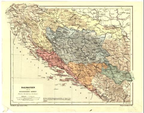
Dalmatien und das occupations gebiet : (Bosnien,...
Section: Maps, plans and nautical charts
Uniform title: YUGOSLAVIA. Mapas generales. 1:2000000 (187)
Title: Dalmatien und das occupations gebiet : (Bosnien, Herzecovina u Novibazar) / cd. Holzel's geogr. Institut in Wien
Material or type of resouce Area: Escala 1:2000000 ; [proyec. cónica]
Publication: In Wien : Verlag von Ed. Holzel, [187- ?]
Physical description: 1 mapa : col. ; 22'1x28'8 cm en h. de 26'2x33'3 cm
Notes: Escalas gráficas de 15 millas [= 5'5 cm] y 100 Kilómetros [= 5 cm]. Coordenadas referidas al meridiano de Hierro (E31°40'-E38°20'/N45°55'-N42°00'). Red geográfica de 1° en 1°
Relieve representado por normales
Materia / lugar / evento: Mapas generales
Divisiones administrativas
Siglo XIX
Other authors: Holzel, Eduard
UDC: 912(497.1-2/5)'1870/1879'
497.1-2/-5
Type of publication:
![]() Maps
Maps
Préstamo:
![]() Disponible
Disponible


