Oguela]


Section: Maps, plans and nautical charts
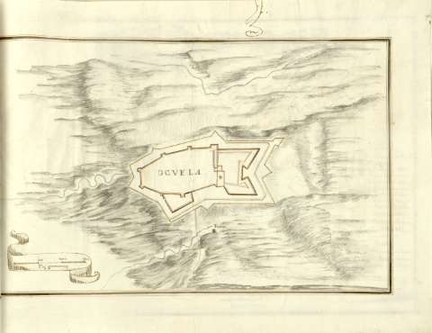
Uniform title: OGUELA (Portugal). Fortificaciones (180). 1:1400
Title: Oguela]
Material or type of resouce Area: Escala [ca. 1:1400], 300 Pies geometricos [= 6,2 cm]
Publication: [180- ?]
Physical description: 1 plano : ms., col. ; 21,6x33,7 cm en h. de 29,41 cm
Content type: Imagen cartográfica
Media type: computadora
Carrier type: recurso en línea
Notes: En : Atlas de fortificaciones del Reino de Portugal y de Extremadura
Título propio redactado a partir del contenido del documento
Manuscrito firmado y rubricado ilegible
Manuscrito a plumilla en tinta negra e iluminado a la acuarela en gris, azul, amarillo y siena
Relieve representado por sombreado
Filigrama : con anagrama de escudo
Indica fuente
Escala enmarcada en cartela
En : Atlas de fortificaciones del Reino de Portugal y de Extremadura
Materia / lugar / evento: Fortificaciones
S.XIX
UDC: 912:623.2(469 Oguaela)'1800/1809'
469 Oguela
Type of publication:
 Maps
Maps
Rights:
Préstamo:
 Disponible
