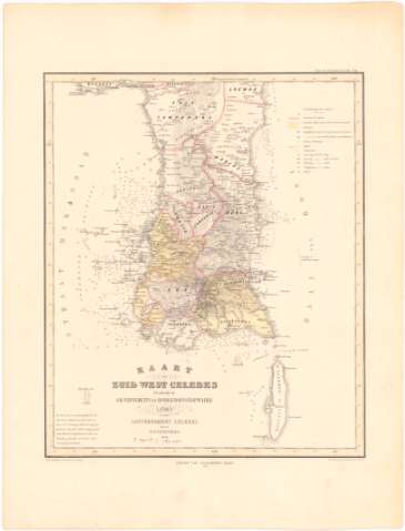
Kaart van Zuid West Celebes : berattende de...


 Maps, plans and nautical charts
Kaart van Zuid West Celebes : berattende de Gouvernements en Bondgenootschappelijke Landen van het Gouvernement Celebes (1869)
Maps, plans and nautical charts
Kaart van Zuid West Celebes : berattende de Gouvernements en Bondgenootschappelijke Landen van het Gouvernement Celebes (1869)
 Disponible Holdings
 Section: Maps, plans and nautical charts
Title: Kaart van Zuid West Celebes : berattende de Gouvernements en Bondgenootschappelijke Landen van het Gouvernement Celebes / dooz W.F. Versteeg ; Lthographie v. D. Heyse te Hage ; geteek d. Coonenberg & Bohn
Material or type of resouce Area: Escala [ca. 1:900000] (E118°50'-E121°10'/S3°30'-S6°30')
Publication: [Amsterdam ?] : Uitgarre van Gualtherus Kofkk, 1869
Physical description: 1 carta náutica : col. ; 39,2x40,7 en h. de 53,7x40,8
Content type: Imagen cartográfica
Media type: computadora
Carrier type: recurso en línea
Notes: Pertenece al 'Atlas van Nederlandsch Indie. - N. 20'
Escala hallada a partir de diez minutos de la latitud
Relieve representado por normales y sondas batimétricas
Indica veriles y bajos
Tabla de signos convencionales para indicar los limites administrativos
Other authors: Versteeg, W.F
Hegse, D
Cronenberg
UDC: 912:[551.46:551.42](91-14 Célebes,islas)'1860'
91-14 Célebes, islas
Type of publication:
Maps
Rights:
Préstamo:
Disponible
