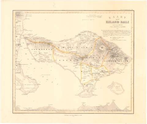
Kaart van het Eiland Bali


Section: Maps, plans and nautical charts
Uniform title: BALI (Indonesia). Mapas generales. 1869 (1856-1869). 1:400000
Title: Kaart van het Eiland Bali / Tezamengesteld door P. Baron Melvill van Cannbee ; Geteek door Cronenberg & Wolff
Material or type of resouce Area: Escala [ca. 1:400000], 2 duítsche Mijlen [= 3,5 cm] (E7°35'-E115°45'/S7°50'-S8°59')
Publication: [Amsterdam ?] : Nitgave van Gualtherus Kolff, 1869
Physical description: 1 mapa : col. ; 38x32,3 cm en h. de 53,7x40,8 cm
Content type: Imagen cartográfica
Media type: computadora
Carrier type: recurso en línea
Notes: Presenta además un perfil
Relieve representado por curvas de configuración
Indica veriles, bajos y sondas batimétricas
Pertenece al 'Atlas van Nederlandsch Indie. - N 31'
Materia / lugar / evento: Mapas generales
Islas
Batimetría
1869
Other authors: Melvill van Carnbee, P Barón
Cronenberg
Kolff, Gualtherus
UDC: 912:[551.46:551.42](91 Bali,isla)'1856/1869'
91 Bali, isla
Type of publication:
 Maps
Maps
Rights:
Préstamo:
 Disponible
