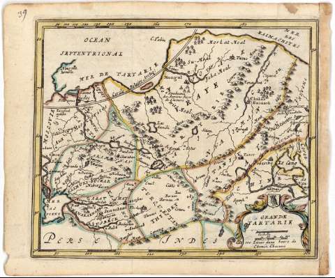
Grande Tartarie


Section: Maps, plans and nautical charts
Uniform title: TARTARIA. Mapas generales (166). 1:31000000
Title: Grande Tartarie
Material or type of resouce Area: Escala [ca. 1:31000000], 100 lienes d'une heure de chemin chacune [= 1,8 cm]
Publication: [Bruxelles : J.P. Harrewys, 166- ?]
Physical description: 1 mapa : col. ; 15,3x18,3 cm
Content type: Imagen cartográfica
Media type: computadora
Carrier type: recurso en línea
Notes: Coordenadas referidas, al parecer, al meridiano de Paris (E85°00'-E167°00'/N80°00'-N30°00')
Relieve de perfil
En el angulo superior izquierdo, '39'
Titulo y escala enmarcado en cartela
Materia / lugar / evento: Mapas generales
Divisiones administrativas
S.XVII
Other authors: Harrewys, J. P
UDC: 912(57-328 Tartaria)'1660/1669'
57-328 Tartaria
Type of publication:
 Maps
Maps
Rights:
Préstamo:
 Disponible
