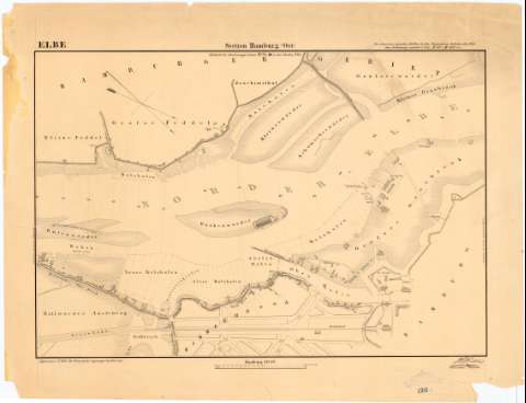
Elbe. Section Hamburg (Ost)
Section: Maps, plans and nautical charts
Title: Elbe. Section Hamburg (Ost) / H. Hubbe Wasserban Diretor
Material or type of resouce Area: Escala [ca. 1:6000], 2000 Fuss Hambg. [= 9,5 cm]
Publication: Hamburg : [Editor no identificado], 1843
Physical description: 1 plano ; 33,6x49,5 cm en h. de 45,6x57,5 cm
Content type: Imagen cartográfica
Media type: computadora
Carrier type: recurso en línea
Notes: Orientado con flechas en cuadrante
Indica las obras realizadas en el puerto de Hamburgo sobre el río Elba
Se dispone del documento con sig. SG+Ar.L-T.9-C.5-153 en el que figura la parte oriental de la ciudad de Hamburgo
Procede de la 'Colección Rico y Sinobas', N 26
Materia / lugar / evento: Ingeniería portuaria y costera
Canales
1846
Elba (Río)
Other authors: Huebbe, Heinrich
UDC: 912:[627.2/.3:626.1]1841/1846'
(282.05 Elba)
Type of publication:
![]() Maps
Maps
Préstamo:
![]() Disponible
Disponible


