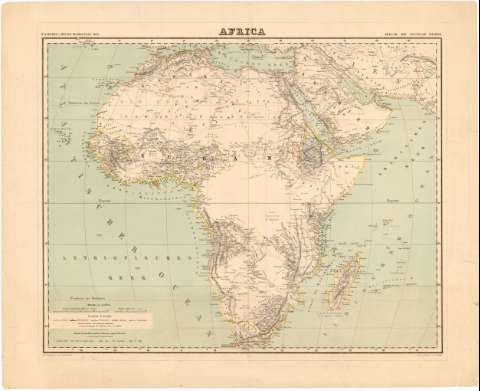
Africa


Section: Maps, plans and nautical charts
Uniform title: AFRICA. Mapas generales. 1:20000000 (1878)
Title: Africa / H. Kiepert ; Schrift gestochen von H. Herzlerg ; Terrain gestochen von W. Bembf
Material or type of resouce Area: 1:20000000
Publication: Berlin : Bey Dietrich Reimer, [1878]
Physical description: 1 mapa : col. ; 41,8 x 53 cm en h. de 51,3 x 63,4 cm
Content type: Imagen cartográfica
Media type: computadora
Carrier type: recurso en línea
Notes: En: H. Kiepert's Neuer Handatlas. Mapa 33
Escala gráfica de 200 millas geográficas alemanas y 500 millas inglesas. Coordenadas referidas al meridiano de Hierro (O 10°-E 90°/N 38°-S 34°). Red geográfica de 10° en 10°
Relieve representado por normales
Relación de colonias europeas indicadas por clave cromática
Materia / lugar / evento: Mapas generales
Colonias
Fronteras
Topónimos antiguos
1878
Arabia
África
Other authors: Kiepert, Heinrich
Bembf, W
Reimer, Dietrich
Herzberg, H
UDC: 912:[341.22:325.45](6)'1878'
53
Type of publication:
 Maps
Maps
Rights:
Préstamo:
 Disponible
