The East-India Pilot or Oriental Navigator : containing A...


 Maps, plans and nautical charts
The East-India Pilot or Oriental Navigator : containing A Complete Collection of charts, Maps, Plans &c. &c. for the... (1783-1788)
Maps, plans and nautical charts
The East-India Pilot or Oriental Navigator : containing A Complete Collection of charts, Maps, Plans &c. &c. for the... (1783-1788)
 Disponible Holdings
 Section: Maps, plans and nautical charts
Uniform title: Mundo. Cartas náuticas. Varias escalas (1793-1878)
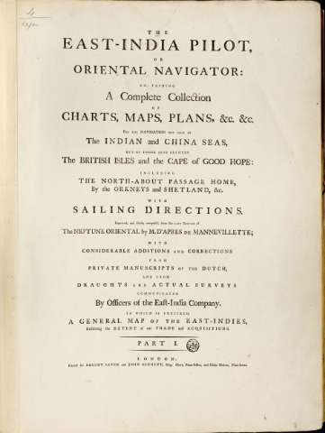
Title: The East-India Pilot or Oriental Navigator : containing A Complete Collection of charts, Maps, Plans &c. &c. for the navigator not only of the Indian and China seas, but of those also between the British isles and the Cape of Good Hope : including the north-about passage home, By the Orkneys and Shetland, &c. with sailing Directions / Improved and chiefly composed from the last edition of the Neptune Oriental By M. D'Aprés de Mannevillette... Communicated by Officers of the East-India Company... ; printed for Robert Sayer and John Bennett
Material or type of resouce Area: Escalas dif
Publication: London : Robert Sayer and John Bennett, 1783-1788
Physical description: 1 atlas (2 v.) (v. I: 93 h.; v. II: 94 h.) : 54 mapas ; 63 cm
Content type: Imagen cartográfica
Media type: computadora
Carrier type: recurso en línea
Notes: La mayor parte de los mapas que componen el presente atlas son cartas náuticas de diferentes zonas del globo
Los documentos graduados en general toman como meridiano principal el de Ferro o el de Londres
Encasi todos los documentos consta escala gráfica, expresada en leguas marinas y aparecen orientados con lis
Presentan análisis batimétrico de la zona
Materia / lugar / evento: Cartas náuticas
Atlas
Perspectivas de costas
Other authors: Mannevillette, Jean Baptiste Nicolas Denis d'Aprcs de
Robert Sayer and John Bennett (Firma)
UDC: 912:551.468]:742]:551.42+551.468:627.22(100)"17"(084.4)
100
Type of publication:
Maps
Rights:
Préstamo:
Disponible
