Horan


Section: Maps, plans and nautical charts
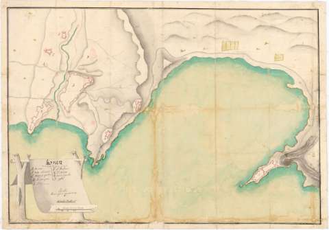
Uniform title: ORAN (Argelia). Fortificaciones. 1:8000 (17)
Title: Horan
Material or type of resouce Area: Escala [ca. 1:8000], 300 tues [= 7 cm]
Publication: [17--]
Physical description: 1 plano : ms., col., montado sobre tela ; 44,6x63,9 cm
Content type: Imagen cartográfica
Media type: computadora
Carrier type: recurso en línea
Notes: Manuscrito a plumilla en tinta negra y roja, coloreado a la acuarela en verde, carmín y gris
Relieve representado por sombreado
Título en pergamino
Materia / lugar / evento: Fortificaciones
Siglo XVIII
UDC: 912:623.2(65 Orán)'17'
65 Orán
Type of publication:
 Maps
Maps
Rights:
Archivo Cartográfico de Estudios Geográficos del Centro Geográfico del Ejército
Collection: PCGE — Location: AR — Call number: Ar.Q-T.10-C.2-81 — Código de barras: 2211964
Préstamo:
 Disponible

© Ministerio de Defensa de España
P. de la Castellana, 109 28071 Madrid.
Tlf: (34) 91 395 50 00
Email: patrimonio.cultural@oc.mde.es