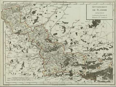
Gouvernement de Flandre : [carte] : comprenant la Flandre...


 Maps, plans and nautical charts
Gouvernement de Flandre : [carte] : comprenant la Flandre françoise, le Hainaut et le Cambresis (1797?)
Maps, plans and nautical charts
Gouvernement de Flandre : [carte] : comprenant la Flandre françoise, le Hainaut et le Cambresis (1797?)
 Disponible Holdings
 Section: Maps, plans and nautical charts
Uniform title: Norte (Francia) (Región). Mapas generales (1797). 1:440043
Title: Gouvernement de Flandre : [carte] : comprenant la Flandre françoise, le Hainaut et le Cambresis / P.F. Tardieu sculp. ; Dubvisson scrip.
Material or type of resouce Area: Escala [ca. 1:440.043]. 10 Lieves communes de France de 2282T. de 25 au Degré [= 10,1 cm]
Publication: Paris : Chez Mr. Mentelle ..., Rue de Seine Fauxbourg S. Germain..., [1797?]
Physical description: 1 mapa : col. ; 34 x 49 cm
Content type: Imagen cartográfica
Media type: computadora
Carrier type: recurso en línea
Notes: Escala gráfica además en 'Grande Lieves de 2853 Toises de 20 au Degré'. Coordenadas: (O0º05'-E2º30'/N51º8'-N49º48'). Meridiano de París y meridiano de hierro
Márgenes graduados. - Relieve representado por sombreado. - Red hidrográfica destacada. - Divisiones administrativas delimitadas por línea de color. - Representación esquemática de la vegetación. - Toponimia
Copia digital. España : Ministerio de Cultura. Dirección General del Libro, Archivos y Bibliotecas, 2010
Other titles: En: Atlas nouveau. - Paris : Chez Mr. Mentelle Historiographe de Monseigneur le Comte d'Antois, Rue de Seine Fauxbourg S. Germain, Hotel de Mayence, [1797 ?]
Materia / lugar / evento: Mapas generales
Divisiones administrativas
Carreteras
Redes de transporte
Topónimos antiguos
Norte (Francia)
Henao
Cambrai
Francia
Other authors: Dubuisson, 17..-18
Tardieu, Antoine-François, 1757-1822
Mentelle, Edmé, 1730-1815
UDC: (44)
Type of publication:
Maps
Rights:
Préstamo:
Disponible
