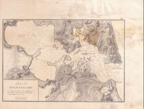
Puerto del Guantánamo


Section: Maps, plans and nautical charts
Uniform title: Guántanamo (Cuba) (Bahía). Cartas náuticas. 1:68587 (18)
Title: Puerto del Guantánamo
Material or type of resouce Area: Escala [ca. 1:68587]
Publication: [Cuba?: s.n. : 18--]
Physical description: 1 carta náutica ; 21 x 31 cm
Content type: Imagen cartográfica
Media type: computadora
Carrier type: recurso en línea
Notes: Escala hallada por comparación con otros documentos de características similares. Coordenadas de la bahía de Guantánamo referidas al meridiano de Cádiz (O 68°56'59''/N 15°54'05'')
Relieve por normales. Sondas batimétricas y veriles
Clave hidrográfica para determinar la calidad del fondo
Materia / lugar / evento: Cartas náuticas
Bahías
S.XIX
Guantánamo (Bahía)
UDC: 729.16-12
Type of publication:
 Maps
Maps
Rights:
Préstamo:
 Disponible
