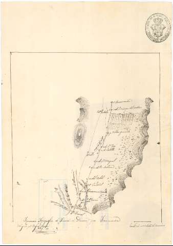
Itinerario topográfico de Teruel a Daroca por Torremocha


 Disponible Holdings
 Section: Maps, plans and nautical charts
Uniform title: Teruel. Itinerarios topográficos. Español. 1:270.000 (s. XIX)
Title: Itinerario topográfico de Teruel a Daroca por Torremocha / dibujado pr. Rafael Negron
Material or type of resouce Area: Escala [ca. 1:270.000]
Publication: [s. XIX]
Physical description: 1 mapa : ms., col. ; 29,8 x 20,8 cm
Content type: Imagen cartográfica
Media type: computadora
Carrier type: recurso en línea
Notes: Itinerario inacabado, pues falta la parte desde el lugar de Torremocha de Jiloca hasta la ciudad de Daroca, comprendiendo, por lo tanto, parte de los términos municipales de Caudé Villarquemado, Torremocha de Jiloca, y Teruel, en la provincia de este nombre pasando por los municipios de los citados términos
Firmado y rubricado por el autor
Escala gráfica de una hora de camino [= 2,05 cm]
Orografía por normales
Consta el sello de la Dirección General del Cuerpo de Estado Mayor del Ejército
Materia / lugar / evento: Itinerarios topográficos
Torremocha de Jicola
Teruel (Provincia)
Daroca
UDC: 912:528.42(465.231.9)"18"
465.231.9 Teruel, Término Municipal
465.231.9 Torremocha de Jiloca, Término Municipal
Type of publication:
 Maps
Maps
Rights:
Préstamo:
Disponible
