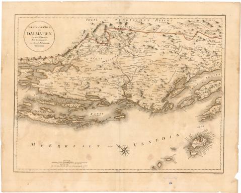
Westlicher Theil von Dolmatien


Section: Maps, plans and nautical charts
Uniform title: DALMACIA (Croacia). Mapas generales. 1:400000 (1789)
Title: Westlicher Theil von Dolmatien / von Herrn P. Santini J.W. Engetmau scrip. V.
Material or type of resouce Area: Escala [ca. 1:400000], 5 Deutsche ad geographische Meilen [= 8,5 cm]
Publication: [Alemania] : Neu herausgegeben von Hern F.A. Schraembl, 1789
Physical description: 1 mapa : col. ; 46,5x61,5 cm en h. de 58x69 cm
Notes: Escala grafica de 20 Italienische Meilen [= 9 cm]. Coordenadas referidas a un meridiano que no se especifica (O44°20'-O43°10'/N33°40'-N31°45')
Orientado con lis en rosa de 8 vientos
Relieve de perfil
En el margen superior derecho' N. 93 C
Procede de la 'Colección Rico y Sinobas' n 68
Materia / lugar / evento: Mapas generales
1789
Other authors: Santini, P
Engetman, J. W
Schraembl, Franz Anton, 1751-1803
UDC: 912(497.1-328 Dalmacia)'1789'
497.1-328 Dalmacia
Type of publication:
 Maps
Maps
Rights:
Préstamo:
 Disponible
