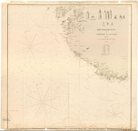
Den Norske Kyst tra Faerder til Udsire


Section: Maps, plans and nautical charts
Uniform title: Noruega. Cartas nauticas (1865). 1:350000
Title: Den Norske Kyst tra Faerder til Udsire / udgivet af Den Geografiske Opmaaling ; Tegnet H. Wille og Brodtkort ; Graveret in den geografiske Opmaailings Kobbeistikke
Material or type of resouce Area: Escala [ca. 1:350000 ; proyec. cónica] (E3#30'-E7#46'/N59#20'-N57#5')
Publication: [Christiania (Oslo) : Den Geografiske Opmaaling], 1865
Physical description: 1 carta nautica : col. ; 76,4x81,1 cm
Notes: Presenta además nueve alzados
Escala hallada a partir de un minuto de latitud [= 32 cm]. Red geográfica de 30' en 30'. Orientado con flecha en nudo de rumbos. Figura ángulo de declinación magnética
Relieve representado por normales
Indica veriles, bajos, fondeaderos y sondas batimétricas. Clave hidrográfica para determinar la calidad del fondo
En el margen superior : Vestre Plade, fra Mandal til Udsire
Señala faros con el fanal iluminado en amarillo y rojo y el ángulo de alcance de su luz
Procede de la 'Colección Rico y Sinobas'
Materia / lugar / evento: Cartas náuticas
1865
Vest-Agder
Rogaland
UDC: 912:551.42(481-13)'1865'
(481-328 Vest-Agder)
(481-328 Rogaland)
Type of publication:
 Maps
Maps
Rights:
Préstamo:
 Disponible
