Plan von Paris


Section: Maps, plans and nautical charts
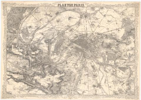
Title: Plan von Paris / Terrain von Fritz
Material or type of resouce Area: Escala 1:49240
Publication: Deutchland] : Lith von Schischa, [187-]
Physical description: 1 mapa : montado sobre tela ; 47,5x69,5 cm en h. de 53, 5x75 cm
Notes: Escala gráfica de 2000 'Wiener - Klafter' [= 7,6 cm]
Relieve representado por normales
Indica murallas y fortificaciones
FRN
Materia / lugar / evento: Mapas generales
Siglo XIX
Isla de Francia
UDC: 912(44-328 Isla de Francia)'1870/1879'
44-328 Isla de Francia
Type of publication:
 Maps
Maps
Rights:
Archivo Cartográfico de Estudios Geográficos del Centro Geográfico del Ejército
Collection: PCGE — Location: AR — Call number: Ar.H-T.4-C.5-138 — Código de barras: 2209905
Préstamo:
 Disponible

© Ministerio de Defensa de España
P. de la Castellana, 109 28071 Madrid.
Tlf: (34) 91 395 50 00
Email: patrimonio.cultural@oc.mde.es