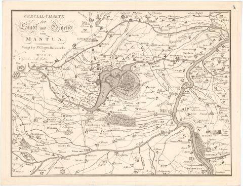
Special-Charte der Stadt und Regend von Mantua


 Disponible Holdings
 Section: Maps, plans and nautical charts
Uniform title: MANTUA (Italia) (Provincia). Mapas generales (17). 1:125000
Title: Special-Charte der Stadt und Regend von Mantua / Gestochen von Ch. Junker
Material or type of resouce Area: Escala [ca. 1:125000]
Publication: Wien : Verlegt bey J.V. Degen, [17-- ?]
Physical description: 1 mapa ; 28,2x37,6 cm en h. de 31,7x41,4 cm
Notes: Orientado con flecha en cuadrante
En el margen superior derecho : 5.
Indica fortificaciones, núcleos de población y caminos
ITL
Materia / lugar / evento: Mapas generales
Fortificaciones
Siglo XVIII
Mantua
Other authors: Degen, J.V
Junker, Christoph
UDC: 912:623.2(45-328 Mantua)'1700/1799'
(45 Mantua)
Type of publication:
 Maps
Maps
Rights:
Préstamo:
Disponible
