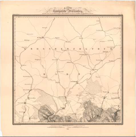
Topographischer Atlas des Koenigreichs Wurttemberg in 55...
Section: Maps, plans and nautical charts
Title: Topographischer Atlas des Koenigreichs Wurttemberg in 55 Blattern / nach den Ergebnissen der Landesvermessung bearbeited und herausgegeben von dem R. Statistich Topographischen Bureau ; Lithogr. V.C. Sommer... [et. al.]
Material or type of resouce Area: Escala 1:50000
Publication: [Alemania ? : [Editor no identificado]], 1821-1851
Physical description: 1 mapa en 55 h. ; h. de 56,5x58,7 cm
Content type: Imagen cartográfica
Media type: computadora
Carrier type: recurso en línea
Notes: Coordenadas referidas, al parecer, al meridiano de Hierro (E25°40'-E28°9'/N49°34'-N47°30')
Relieve representado por normales
Tabla de signos convencionales para indicar núcleos de población de distinta categoria, caminos, lineas ferroviarias, tipos de suelo, etc.
Sello en seco del Deposito de la Guerra
Inserta : Vebersicht im Maastabe 1:1000000 naturalicher Grosse
Materia / lugar / evento: Mapas topográficos
1851
UDC: 912:528.4(430-328 Baden Wurtemberg)'1821/1851'
430-328 Baden Wurtemberg
Type of publication:
![]() Maps
Maps
Préstamo:
![]() Disponible
Disponible


