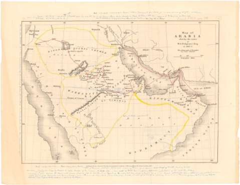
Map of Arabia : shewing the routes of W.G. Palgrave Esq....


 Maps, plans and nautical charts
Map of Arabia : shewing the routes of W.G. Palgrave Esq. in 1862-3 : The orthography of the author has been followed (1865)
Maps, plans and nautical charts
Map of Arabia : shewing the routes of W.G. Palgrave Esq. in 1862-3 : The orthography of the author has been followed (1865)
 Disponible Holdings
 Section: Maps, plans and nautical charts
Title: Map of Arabia : shewing the routes of W.G. Palgrave Esq. in 1862-3 : The orthography of the author has been followed / A. Findlay
Material or type of resouce Area: [Ca. 1:10000000], 200 geographie miles [= 3,4 cm]
Publication: London : published for the Journal of the Royal Geographical Society, by J. Murray, Albemarle Street, 1865
Physical description: 1 mapa : col. ; 17,1 x 23,8 cm en h. de 22,1 x 28,7 cm
Content type: Imagen cartográfica
Media type: computadora
Carrier type: recurso en línea
Notes: Proyec. cónica. Coordenadas referidas, al parecer, al meridiano de Londres (E 35°-E 62°/N 33°-N 15°). Red geográfica de 5 en 5 grados
Relieve representado por normales
Anotaciones manuscritas en azul en los márgenes de todo el mapa que parecen ser de Coello
Materia / lugar / evento: Mapas itinerarios
Expediciones geográficas
Penínsulas
1862
1863
Arabia
Asia
Other authors: Findlay, Alexander
Murray, John
UDC: 912:[656.02:910.4](53)'1862/1863'
53
Type of publication:
Maps
Rights:
Préstamo:
Disponible
