Karte von den Kurfurstenthum Hessen : Lithographirt in...


 Maps, plans and nautical charts
Karte von den Kurfurstenthum Hessen : Lithographirt in 40 Blattern nach 1/50000 d.w.G. (1840-1855)
Maps, plans and nautical charts
Karte von den Kurfurstenthum Hessen : Lithographirt in 40 Blattern nach 1/50000 d.w.G. (1840-1855)
 Disponible Holdings
 Section: Maps, plans and nautical charts
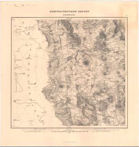
Title: Karte von den Kurfurstenthum Hessen : Lithographirt in 40 Blattern nach 1/50000 d.w.G. / [Von Dem Topographischen Bureau Des Kurfustlich Hecsischen Generalstabes] ; lith. V F. Koke
Material or type of resouce Area: Escala 1:50000
Publication: [Alemania ?] : aufgenomen von dem Topographischen Bureau des Kurfurstlich Hessischen Generaltstabes, 1840-1855
Physical description: 1 mapa en 40 h. ; h. de 60x67 cm ó menos
Content type: Imagen cartográfica
Media type: computadora
Carrier type: recurso en línea
Notes: Escalas graficas de 1 Reise stunete = 1/25 Aeq. Crad = 118, 15 Rthn, 26000 Kurhess Mile = 26000 Kh. F = 1986 1/9 Rthn etc.
Coordenadas referidas al meridiano de Hierro (E26°00'-E28°20'/N51°48'-50°0')
Relieve representado por sombreado
Tabla de signos convencionales para indicar los diferentes tipos de vegetacion al igual que la diferente composición del suelo
Inserta : Vebersicht der Kartenblatler. - Escala 1:1,500000
Sello en seco
Materia / lugar / evento: Mapas generales
S.XIX
Other authors: Koke, F
Pyramius, Christoph
Alemania. Topographischen Bureau des Kurfurstlich Messischen Generalstabes
UDC: 912(430-328 Hesse)'1840/1855'
430-328 Hesse
Type of publication:
Maps
Rights:
Préstamo:
Disponible
