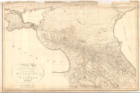
General Map of the countries : Comprehended between the...
Section: Maps, plans and nautical charts
Uniform title: CAUCASIA (Rusia) (Región). Mapas generales. 1:1400000 (1788)
Title: General Map of the countries : Comprehended between the Black sea and the Caspian / Engraved by S.J. Neele, N 352 Strand
Material or type of resouce Area: Escala [ca. 1:1400000], 130 Russian Versts [= 9'9 cm] ; [proyec. cónica]
Publication: London : Publishid by Edwards N 102 Pall Mall, March 30 1788
Physical description: 1 mapa ; 63'5x96'8 cm
Content type: Imagen cartográfica
Media type: computadora
Carrier type: recurso en línea
Notes: Comprende la región Caucásica al Suroeste de la Unión Soviética
Escala gráfica de 90 millas inglesas [= 9'9 cm]. Coordenadas referidas al meridiano de Hierro (E51°20'-E67°00'/N47°10'-N39°30') y al meridiano de Paris (E30°30'-E48°00'/N47°10'-N39°30'). Red geográfica de 1° en 1°
Relieve de perfil
Materia / lugar / evento: Mapas generales
1788
Other authors: Edwards
Neele, Samuel John, 1758-1824
UDC: 912(47-328 Caucasia)'1788'
47-328 Caucasia
Type of publication:
![]() Maps
Maps
Préstamo:
![]() Disponible
Disponible


