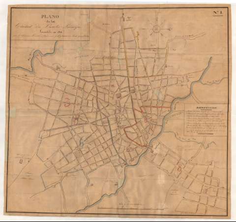
Plano de la ciudad de Puerto-Principe


Section: Maps, plans and nautical charts
Uniform title: Camagüey (Cuba). Planos de población. 1:3304 (1832)
Title: Plano de la ciudad de Puerto-Principe / Levantado en 1832 por Dn. Francisco lavallee, Agrimensor pubo. y titular de Real Hacienda, etc
Material or type of resouce Area: Escala [ca. 1:3304], mil varas castellanas [= 25'3 cm]
Publication: 1832
Physical description: 1 plano : ms., col. ; 81.0 x 86.1 cm
Content type: Imagen cartográfica
Media type: computadora
Carrier type: recurso en línea
Notes: Orientado con flechas al norte geográfico y magnético en rosa de cuatro vientos
Relación, entre otros, de los principales ríos, caminos, edificios, calles y plazas, indicados por clave numérica
Límite entre los distintos barrios diferenciados por color
Dibujado a varias tintas y lavado en varios colores
En el ángulo superior derecho: "No. I"
Documento relacionado con el de sign. SH+13452/5-7/18 que es una copia de éste
Materia / lugar / evento: Planos de población
Mapas generales
Topónimos antiguos
1832
Camagüey
Other authors: Lavallée, Francisco, 1800-1864
UDC: 729.15 Camagüey
Type of publication:
 Maps
Maps
Rights:
Préstamo:
 Disponible
