Puerto Padre


Section: Maps, plans and nautical charts
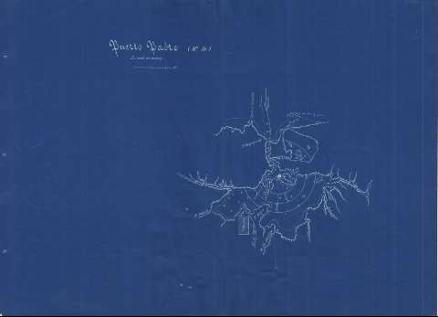
Title: Puerto Padre
Material or type of resouce Area: Escala [ca. 1:83333], 3000 metros
Publication: [1889?]
Physical description: 1 carta náuticas ; 44 x 60 cm
Content type: Imagen cartográfica
Media type: computadora
Carrier type: recurso en línea
Notes: Orientado con media flecha
Indica sondas batimétricas y veriles, expresadas en metros, bajos, dirección de las corrientes marinas, así como las distintas líneas de derrota a seguir para arribar a la bahía
Clave hidrográfica para determinar la calidad del fondo
Es una fotocopia en ferroprusiato
Pertenece a: "Memorias de la comisión de estudios y defensa de costas de la Isla de Cuba. Croquis 1889 correspondiéndose con la "(No. 10)"
Materia / lugar / evento: Cartas náuticas
Batimetría
Bahías
1889
UDC: 729.16-16
Type of publication:
 Maps
Maps
Rights:
Préstamo:
 Disponible
