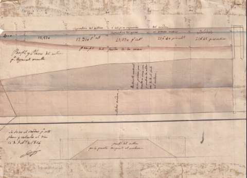
Perfil y plano del relleno para llegar al muelle


 Disponible Holdings
 Section: Maps, plans and nautical charts
Title: Perfil y plano del relleno para llegar al muelle
Material or type of resouce Area: Escala [ca. 1:135]. 50 varas [= 30,9 cm]
Publication: 1814
Physical description: 1 mapa : ms., col. ; 28 x 38 cm
Content type: Imagen cartográfica
Media type: computadora
Carrier type: recurso en línea
Notes: Presenta el perfil del fondo de la mar y el perfil delrelleno por la parte tangente al malecón
Firmado y rubricado por el autor
Manuscrito a plumilla en tinta negra y coloreado a la acuarela en azul, marrón y gris
UDC: 729.1
Type of publication:
 Maps
Maps
Rights:
Archivo General Militar de Madrid
Location: PL — Call number: CUB-256/10 — Código de barras: 2129429
Préstamo:
Disponible

© Ministerio de Defensa de España
P. de la Castellana, 109 28071 Madrid.
Tlf: (34) 91 395 50 00
Email: patrimonio.cultural@oc.mde.es