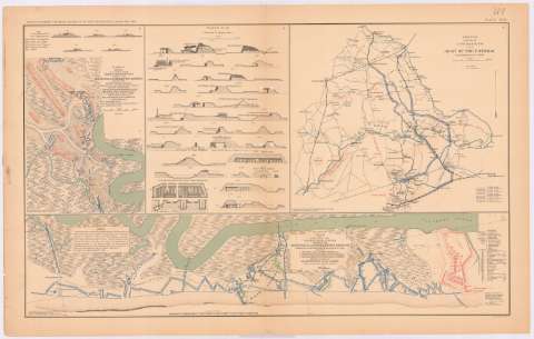
Plan of a portion of the siege operations against the...
Sección: Mapas, planos y cartas náuticas
Título uniforme: CHARLESTON (Estados Unidos) (Virginia Occidental) (Puerto). Asedios. 189. 1:1419 (1863)
Título: Plan of a portion of the siege operations against the defenses of Charleston Harbor showing the left batteries, 1 batteries erected against fort Wagner prior to july 18th. 1863, 2 part of the Breaching batteries erected against fort Sumter used also against fort Wagner and Battery Gregg / executed by order of Maj. General Q.A. Gillmore ; under direction of Maj. T.B. Brooks, ADC, Lieut. CR Suster, USE and Lieut. FS Michie, USE, assistant Engineers
Área de datos: Escala [ca. 1:1419], 200 feet [= 4,3 cm]
Publicación: Washington : Government Printing Office, [189-?] (N.Y. [Nueva York] : Julius Bien & co.)
Descripción física: 1 plano : col. ; 27x18 cm, en h. de 47x75 cm
Tipo de contenido: Imagen cartográfica
Tipo de medio: computadora
Tipo de soporte: recurso en línea
Notas: En : Atlas to accompany the Official Records of the Union and Confederate Armies 1861 - 1865. - Plate XLIV, n 1
Relieve : líneas perpendiculares normales
Orientado con flecha
Inserta : 5 perfiles. - Escala [ca. 1:2068]
Leyenda de abreviaturas
Mapa que acompaña al informe del : Maj. Thomas B. Brooks
Figura en el margen inferior izquierdo : Series I. Vol. XXVIII. Part 1. Page 269
En : Atlas to acompany the Official Records of the Union and Confederate Armies 1861 - 1865
Materia / lugar / evento: Guerra civil
Sitios
Baterías
Arma de Artillería
Fortalezas militares
1863
Estados Unidos
Otros autores: Gillmore, Quincy Adams
Brooks, T. B
Suster, C.R
Michie, P.S
CDU: 912:355.4]:[355.44+623.1+358.1](754 Charleston)
754 Charleston
Tipo de publicación:
![]() Mapas
Mapas
Préstamo:
![]() Disponible
Disponible


