Atlas Geográfico Ibero-Americano. España


 Maps, plans and nautical charts
Atlas Geográfico Ibero-Americano (1901-1903)
- Chías y Carbó, Benito
Maps, plans and nautical charts
Atlas Geográfico Ibero-Americano (1901-1903)
- Chías y Carbó, Benito
 Disponible Holdings
 Section: Maps, plans and nautical charts
Title: Atlas Geográfico Ibero-Americano. España / D. Benito Chías y Carbó ; D. Manuel Escudé Bartolí
Author: Chías y Carbó, Benito
[Atlas Geográfico Ibero-Americano] All editions
Characteristics of the edition: España. Español
Material or type of resouce Area: Varias escalas
Publication: Barcelona : Alberto Martín, Muntaner num. 24, 1901-1903 (Tipografía de J. Vives)
Physical description: 1 atlas (2 volúmenes) ([104] hojas, 535 páginas)) : 52 mapas, color ; 38 x 27 cm
Content type: Imagen cartográfica
Media type: computadora
Carrier type: recurso en línea
Notes: La idea inicial era elaborar una obra que abarcara toda la Península Ibérica y los estados iberoamericanos. La obra consta de 2 volúmenes, uno de texto y otro de mapas, publicada por fascículos. Los 65 primeros fascículos corresponden al estado español. A partir del 66 comienza Portugal. El título de la obra que consta en los 63 primeros fascículos es "Atlas Geográfico de España", a partir de este fascículo figura en la cubierta un nuevo título: "Atlas Geográfico Ibero-Americano"
La fecha de publicación corresponde al período que abarca los mapas que componen el atlas
Los dos volúmenes presentan portada e índice propios
Los mapas de esta edición de Huesca, Cádiz, León, Oviedo y Sevilla fechados en 1901, presentan diferencias en el contenido con respecto a los de 1903. Estas diferencias se aprecian en el trazado de la red fluvial, en los lagos, caminos ordinarios, carreteras, localidades...
Contains: v. 1. "Descripción Geográfica y Estadística de las Provincias Españolas : con el número de habitantes, edificios y viviendas de cada Ayuntamiento, según resulta de los datos provisionales del censo de 1897 por D. Manuel Escudé Bartolí" -- v. 2. "Cartas corográficas cuidadosamente rectificadas por personal facultativo bajo la dirección del capitán de Ingenieros D. Benito Chías y Carbó". Consta de 52 mapas generales de todas las provincias españolas ordenadas alfabéticamente, con orografía por normales y divisiones administrativas diferenciadas por colores
Included records: Alava . - Barcelona : Alberto Martin, 1902
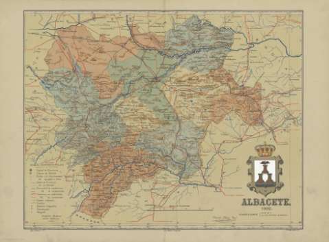
Albacete . - Barcelona : Alberto Martin, 1902
[...] Ver todos los registros incluidos (44)
Materia / lugar / evento: Atlas
Mapas generales
Divisiones administrativas
España
Other authors: Escudé Bartolí, Manuel, 1856-1930
Editorial Alberto Martín
Tipografía de J. Vives
Related titles: Título: Atlas Geográfico de España
Título: Descripción Geográfica y Estadística de las Provincias Españolas
Título: Cartas corográficas
UDC: 912:(1-2/-5)(460)"1903"(084.4)
(460)
Type of publication:
Maps
Rights:
Préstamo:
Disponible
