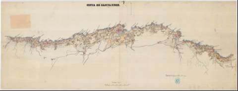
Costa de Santander


Section: Maps, plans and nautical charts
Uniform title: Cantabria. Costas. 1:100.000 (1874)
Title: Costa de Santander
Material or type of resouce Area: Escala 1:100.000
Publication: [1874?]
Physical description: 1 mapa : ms., col., papel tela ; 45,9x122,8 cm
Content type: Imagen cartográfica
Media type: computadora
Carrier type: recurso en línea
Notes: Orientado con flecha al N.
Relieve representado por curvas de configuración
Toponímia. Hidrografía
Aparece en ángulo inferior derecho: 'Madrid 27 de Junio de 1874 = Es copia ='
Manuscrito a plumilla en tinta negra y siena, iluminado en siena, azul, carmín y ocre
UDC: 463.3
Type of publication:
 Maps
Maps
Rights:
Archivo General Militar de Madrid
Location: PL — Call number: S-23/7 — Código de barras: 2106746
Préstamo:
 Disponible

© Ministerio de Defensa de España
P. de la Castellana, 109 28071 Madrid.
Tlf: (34) 91 395 50 00
Email: patrimonio.cultural@oc.mde.es