The solar system


Section: Maps, plans and nautical charts
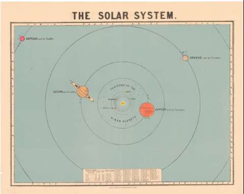
Uniform title: Sistema solar. Mapas celestes. Escala indeterminada (1847)
Title: The solar system
Material or type of resouce Area: Escala indeterminada
Publication: London : Published by James Reynolds, 174, strand, [1847]
Physical description: 1 carta celeste : col. ; 51,1x64,1 cm
Content type: Imagen cartográfica
Media type: computadora
Carrier type: recurso en línea
Notes: Relación de los planetas con la distancia al Sol
Materia / lugar / evento: Mapas celestes
1847
Other authors: Reynolds, James
UDC: 912:[523:524](523)'1847'
Type of publication:
 Maps
Maps
Rights:
Archivo Cartográfico de Estudios Geográficos del Centro Geográfico del Ejército
Location: AR — Call number: Ar.L-T.8-C.2-74 — Código de barras: 2212044
Préstamo:
 Disponible

© Ministerio de Defensa de España
P. de la Castellana, 109 28071 Madrid.
Tlf: (34) 91 395 50 00
Email: patrimonio.cultural@oc.mde.es