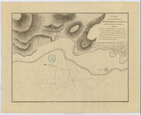
A plan of the Anchorage at Blewfields, Jamaica [sic]


 Disponible Holdings
 Section: Maps, plans and nautical charts
Title: A plan of the Anchorage at Blewfields, Jamaica [sic] / Surveyed by John Leard & Wm. Buller, 1791 ; S.J. Neele sculpt.
Material or type of resouce Area: Escala [ca. 1:14764], one Statute mile [= 10'9 cm]
Publication: London : Published by John Leard & sold by Mount & Davison,Tow er Hill & W. Faden, Geographer to the King, Jan. 1793
Physical description: 1 mapa : Papel agarbanzado ; 43 x 54 cm
Content type: Imagen cartográfica
Media type: computadora
Carrier type: recurso en línea
Notes: Orientado con lis en la que se señala además la variación magnética observada
Relieve por normales. Sondas batimétricas
Relación de los principales puntos del plano, indicados por clave alfabética
Sello del depósito general topográfico de ingenieros
Materia / lugar / evento: Mapas generales
Batimetría
1791
1792
Other authors: Leard, John
Buller, William
Faden, William, 1749-1836
Neele, Samuel John, 1758-1824
Mount & Davidson (Londres)
UDC: 729.2 Bluefields
Type of publication:
 Maps
Maps
Rights:
Préstamo:
Disponible
