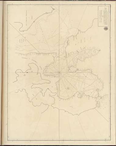
Plan of Nancowry Harbour


Section: Maps, plans and nautical charts
Title: Plan of Nancowry Harbour / From a Survey of Captain Alexander Kyd.
Material or type of resouce Area: Escala [ca. 1:1.500.000] (E93°17'-C93°24'/N8°5'-N7°50')
Publication: [London ?] : Published According to Act of Parliament by Adalrymple, 1792
Physical description: 1 carta nautica ; 46x61 cm en h. de 49x65 cm
Content type: Imagen cartográfica
Media type: computadora
Carrier type: recurso en línea
Notes: En : 'Chart Red 5ea'
Other authors: Kyd, Alexander
Dalrymple, Alexander
UDC: 912:[551.46:627.22:551.42](540 Nicolas islas)'1790/1792'
540 Nicolas islas
Type of publication:
 Maps
Maps
Rights:
Archivo Cartográfico de Estudios Geográficos del Centro Geográfico del Ejército
Location: AR — Call number: Ar.Q-T.4-C.1-84(24) — Código de barras: 2214321
Préstamo:
 Disponible

© Ministerio de Defensa de España
P. de la Castellana, 109 28071 Madrid.
Tlf: (34) 91 395 50 00
Email: patrimonio.cultural@oc.mde.es