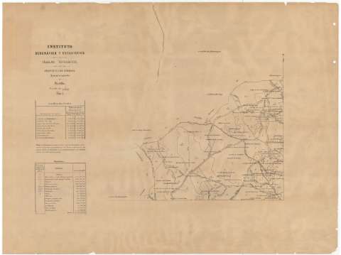
Ayuntamiento de Montilla : provincia de Córdoba


 Disponible Holdings
 Section: Maps, plans and nautical charts
Uniform title: MONTILLA (Córdoba). Mapas catastrales. 1:25.000 (18)
Title: Ayuntamiento de Montilla : provincia de Córdoba / Instituto Geográfico y Estadístico
Material or type of resouce Area: Escala 1:25000
Publication: Madrid : Instituto Geográfico y Estadístico, [18--]
Physical description: 1 mapa en 4 h. ; 79 x 111 cm en h. de 39 x 59 cm
Content type: Imagen cartográfica
Media type: computadora
Carrier type: recurso en línea
Notes: Precede al título: "Trabajos Topográficos"
Orientado con flecha
Notas sobre las coordenadas locales, los diferentes cultivos, la población y las vías de comunicación
Materia / lugar / evento: Mapas catastrales
Cultivos
Núcleos de población
Comunicaciones
S.XIX
Córdoba (Provincia)
Andalucía
Other authors: Instituto Geográfico y Estadístico (España)
UDC: (460.351 Montilla)
Type of publication:
 Maps
Maps
Rights:
Préstamo:
Disponible
Préstamo:
Disponible
Préstamo:
Disponible
